In the previously published Zmanim For Kiddush Levana Before Shavuos 5778 article, we demonstrated how location plays a key role in the earliest time one can recite Kiddush Levana / קידוש לבנה. This article will focus on the Sof Zman Kiddush Levana, or the latest that one can recite Kiddush Levana. In the past we posted the technical Calculating Kiddush Levana Times Using the Zmanim API post, with a simple example of using the KosherJava Zmanim API to calculate Kiddush Levana. Here is a slightly more complex example.
The Bach on the Tur Hilchos Kiddush Hachodesh (Orach Chayim 426 תכ”ו) discusses not reciting Kiddush Levana on Yom Tov.
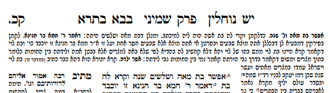
גם נוהגים שאין מקדשין אותה במ״ש שחל בו י״ט כי כן כתב מהרי״ל בסוף הלכות שבועות ובשנת ש״ץ לא היתה נראה הלבנה במוצאי י״כ וגם אח״כ לא היתה נראה עד ליל ט״ו והיינו מקדשין אותה בליל י״ט ולא חששנו על החילוקים כי אין זה אלא קפידא בעלמא כאילו יצא מחוץ לתחום למעלה מעשרה במחשבה להקביל פני השכינה ואין להקפיד אלא לכתחלה דאפשר לקדשה אח”כ כגון שבועות כשחל א״ב אבל בליל ט״ו דסוכות דלא אפשר לברך בלילה שלאחריו דכבר נתמלא פגימתה יש לברך בליל ט״ו
He writes that in Tishrei 5390 (1629) there was cloud cover from Yom Kippur until the first night of Succos. The Bach who was the Rabbi in Kraków at that time (see the Be’er Haitev 426:5), writes that they said Kiddush Levana on the first night of Sukkos. This is right after he mentioned that it is our custom not to recite Kiddush Levana after halfway between molad and molad (following the Maharil and Rema, and not the Mechaber who allows a little extra time). Was tzais (the earliest time to recite Kiddush Levana), on the first night of Succos in Kraków that year (5390 / 1629) after the midpoint between molad and molad? Is the Bach saying that in this case bedieved you should still recite Kiddush Levana, or is he just saying that it can be said on Yom Tov when waiting until after Yom Tov will be too late?
The Impact of Calendar Dechiyos / דחיות
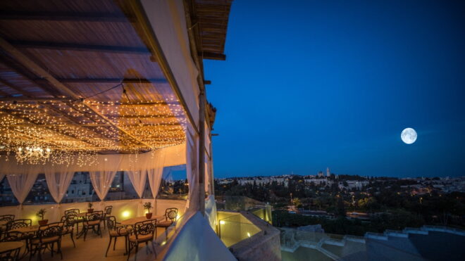
The day of the molad of Tishrei is the target day for the first day of Rosh Hashana. However, the Jewish calendar has four rules that delay the start of the Jewish year by a day or two (in a case of two delays combining), a subject that we will hopefully cover at some point – עוד חזון למועד. If not for these delays known as dechiyos that occur about 60% of all years, the 15th night of the month of Tishrei, would always be early enough to recite Kiddush Levanah. The average lunar month is a drop over 29 and a half days (29 days, 12 hours, 44 minutes and 3.3 seconds), so the halfway point that is the end of the earlier time quoted by the Bach would be 14 days, 18 hours and 22 minutes after the molad. The calculation below shows that in the case of 15 Tishrei, 5390 (the evening of Oct 1, 1629), even the earlier zman for sof zman Kiddush Levana did not happen until the morning of the first day of Succos. The molad of Tishrei that year was about 2.5 hours before the day’s end. This resulted in a dechiya of Molad Zaken / מולד זקן. This delayed Rosh Hashanah by a day pushing it from Monday to Tuesday. There was no dechiya of Lo ADU Rosh / לא אד״ו ראש, so the delay was not as long as it could have been (had there been a combination of the two dechiyos). Sunset on the first night of Sukkos that year in Krakow was at 5:18 pm (using standard time), and the moon rose at 5:54 pm, so they were able to recite Kiddush Levana that night.
Despite dechiyos, the time of tzais in Krakow is before sof zman Kiddush Levana on the first night of Succos approximately 73% of the time, making the ability to recite Kiddush Levanah on the first night of Sukkos for the longitude of Krakow (that is close to Yerushalayim) more common than not. As you will see below, the farther west you go, the less likely it is to happen.
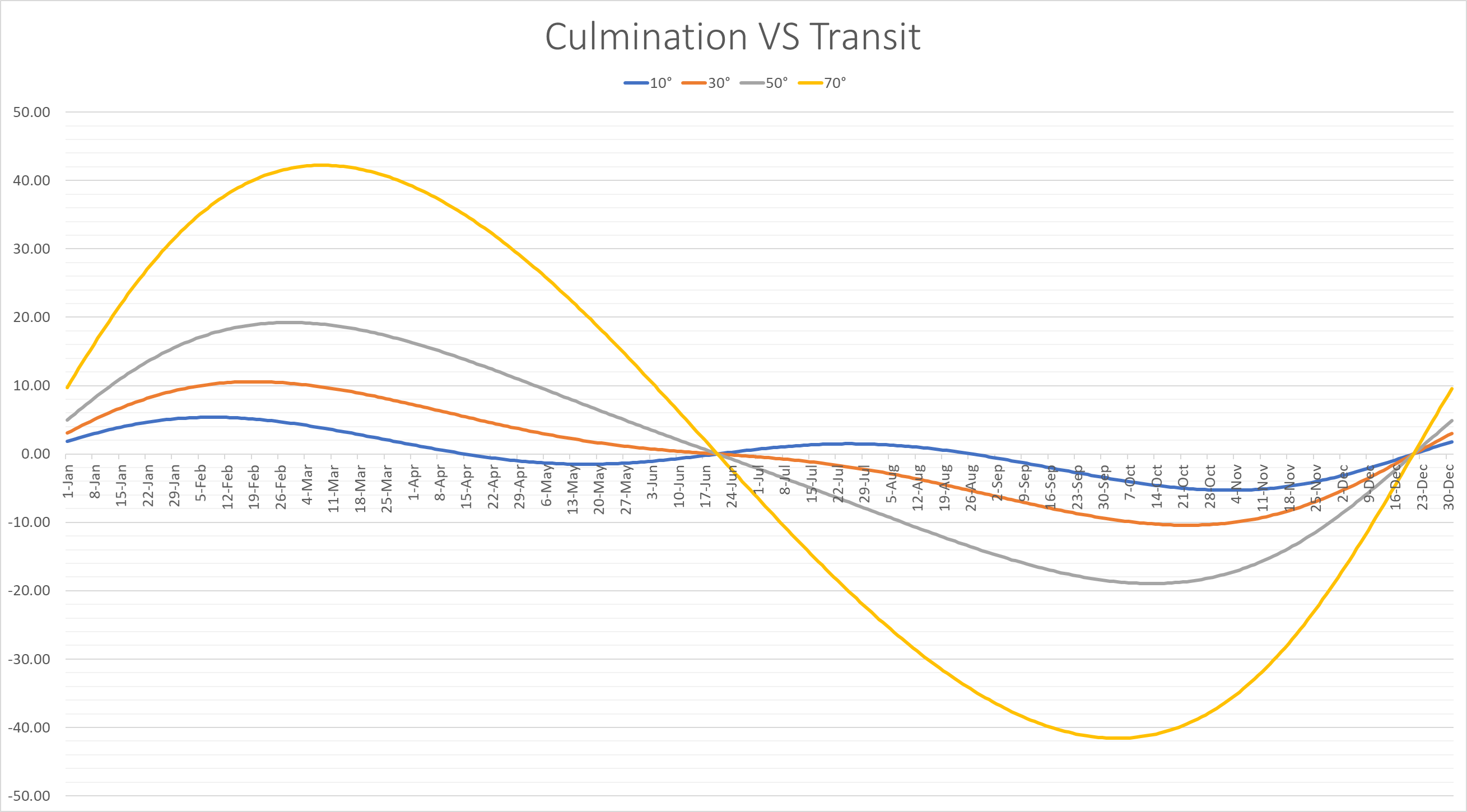
Sof Zman Kiddus Levana Around the World
Being that Sof Zman Kiddush Levana is a fixed time globally, and can’t be said before local tzais, the farther west you are, the less of a probability you have of encountering a late Kiddush Levana. Conversely, the farther east you are, the greater your probability is of encountering a late Kiddush Levana. The chart below was inspired by Rabbi Dovid Heber’s example in his sefer Shaarei Zmanim of the rare ability to recite Kiddush Levana on the 17th of the month in Anadyr, Russia. This town is at the far eastern portion of Russia, not far from the International Date Line. The chart shows the percentage of times that Sof Zman Kiddush Levana in Tishrei and the annual average for various places around the world occurs after tzais (calculated as 8.5°) on the 15th, 16th and 17th of the month.
| 15th – ט״ו | 16th – ט״ז | 17th – י״ז | ||||
|---|---|---|---|---|---|---|
| Location | תשרי | All | תשרי | All | תשרי | All |
| Anadyr, Russia | 91% | 57% | 46% | 18% | N/A | 0.2% |
| Sydney, Australia | 88% | 73% | 42% | 21% | N/A | N/A |
| Yerushalayim | 75% | 57% | 24% | 8% | N/A | N/A |
| Krakow, Poland | 73% | 55% | 22% | 7% | N/A | N/A |
| Lakewood, NJ | 62% | 41% | 8% | 1.6% | N/A | N/A |
| Los Angeles, CA | 56% | 35% | 3% | 0.7% | N/A | N/A |
| Kurima Island, Japan (Chazon Ish) | 39% | 18% | N/A | N/A | N/A | N/A |
Molad Calculation Code Sample
The code below shows rudimentary use of the Jewish Calendar functionality and molad retrieval for the historical date of the Bach’s 1629 Sukkos night kiddush levanah.
int month = JewishDate.TISHREI;
int year = 5390;
JewishDate erevSukkos = new JewishDate(year, JewishDate.TISHREI, 14);
JewishDate molad = JewishDate.getMolad(year, month);
Date tchilas3Days = JewishCalendar.getTchilasZmanKidushLevanah3Days(year, month);
Date tchilas7Days = JewishCalendar.getTchilasZmanKidushLevanah7Days(year, month);
Date sofZmanBetweenMoldos = JewishCalendar.getSofZmanKidushLevanahBetweenMoldos(year, month);
Date sofZmanKidushLevanah15Days = JewishCalendar.getSofZmanKidushLevanah15Days(year, month);
TimeZone krakowTZ = TimeZone.getTimeZone("Europe/Warsaw");
SimpleDateFormat sdf = new SimpleDateFormat("MMM dd, yyyy 'at' HH:mm:ss z");
SimpleDateFormat dayFormat = new SimpleDateFormat("MMM dd, yyyy");
sdf.setTimeZone(krakowTZ);
System.out.println("Molad: " + molad + " / " + dayFormat.format(molad.getTime()) + ", day of week: "
		+ molad.getDayOfWeek() + ", Hours: " + molad.getMoladHours() + ", minutes: " + molad.getMoladMinutes()
		+ ", Chalakim: " + molad.getMoladChalakim());
System.out.println("Tchilas Zman Kidush Levanah 3 Days: " + sdf.format(tchilas3Days));
System.out.println("Tchilas Zman Kidush Levanah 7 Days: " + sdf.format(tchilas7Days));
System.out.println("Erev Succos: " + erevSukkos + " / " + dayFormat.format(erevSukkos.getTime()));
System.out.println("Sof Zman KidushLevanah Between Moldos: " + sdf.format(sofZmanBetweenMoldos));
System.out.println("Sof Zman Kidush Levanah 15 Days: " + sdf.format(sofZmanKidushLevanah15Days));
The output in Central European Time (CET) is:
Molad: 29 Elul, 5389 / Sep 17, 1629, day of week: 2, Hours: 15,
        minutes: 46, Chalakim: 5
Tchilas Zman Kidush Levanah 3 Days: Sep 20, 1629 at 14:25:19 CET
Tchilas Zman Kidush Levanah 7 Days: Sep 24, 1629 at 14:25:19 CET
Erev Succos: 14 Tishrei, 5390 / Oct 01, 1629
Sof Zman KidushLevanah Between Moldos: Oct 02, 1629 at 08:47:21 CET
Sof Zman Kidush Levanah 15 Days: Oct 02, 1629 at 14:25:19 CET
Odds & Ends
While Tishrei has much higher odds than most months for a late Sof Zman Kiddush Levana, Shevat is very close to Tishrei, and sometimes exceeds it. Cheshvan and Kislev are the only variable length Jewish months. In a chaser (Deficient / short) year they will both have the short month length of 29 days. The months of Cheshvan and Kislev are followed by Teves that is always 29 days. With the possibility of three 29-day months in a row and being in the winter with early tzais times, the month of Shevat is the most likely to have a very late sof zman Kiddush Levana, as pointed out by Rabbi Heber in his Shaarei Zmanim.
The reason that Anadyr only has a 57% chance of being able to recite Kiddush Levana year-round on the 15th VS 73% in Sydney, even though Anadyr is 3% more likely to have Kiddush levana on the 15th of Tishrei, is due to the high latitude of Anadyr (64.7° N) that results in 25.4% of the months not having tzais on the 15th.
The closest case to almost not being able to recite Kiddush levanah on the 15th of Tishrei without dechiyos would be in a location immediately to the east of the Chazon Ish dateline such as Kurima Island on a year when the molad was exactly at sunset in Yerushalayim and the true opposition (full moon) was much earlier than the average opposition, causing the moon to rise after sof zman kidush levana. Calculations show that this would never actually happen on Sukkos though it is likely to occur on Pesach since the molad of Nisan is much more likely to be before Rosh Chodesh.